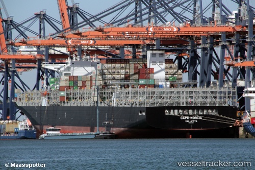
Cape Kortia
Current StatusWhere is the vessel?
Cape Kortia is currently in 46 nm E of Cadaqués, based on AIS data received about 15h ago.
Latest AIS update:
Current position: 42.42840° N, 4.30842° E (46 nm E of Cadaqués)
Average speed (last 7 days): Loading…
Average speed (last 30 days): Loading…
Vessel profile: Cape Kortia is a Container Ship with dimensions 48m x 330m.
This page combines live AIS, route history, probable destination signals, nearby traffic, and port activity for practical vessel monitoring.
The current position of vessel Cape Kortia is 42.42840 lat / 4.30842 lng. Updated: 2026-05-19 08:04:53 UTCNearest reference points:
- 25 nm SW of Carro
- 13 nm E of L'ESTARTIT
- 23 nm SW of Toulon
Details:
Live Vessel Cape Kortia Analytics (details, animations, etc.)
Recent AIS points (UTC):
2026-05-19 04:15:41 UTC · 43.02831, 4.86966 · SOG 11.2 kn · COG 213°2026-05-19 06:05:13 UTC · 42.74541, 4.60405 · SOG 11.7 kn · COG 215°
2026-05-19 07:54:41 UTC · 42.45611, 4.33165 · SOG 11.6 kn · COG 212°
2026-05-19 08:04:53 UTC · 42.42840, 4.30842 · SOG 11.5 kn · COG 210°