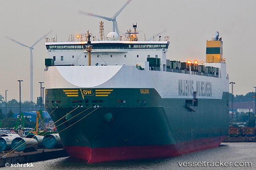
 SALOME
Current Status
Where is the vessel?
SALOME is currently in 211 nm S of Nagybajom, based on AIS data received about 14h ago.
Latest AIS update:
Current position: 42.98107° N, 174.42387° E (211 nm S of Nagybajom)
Average speed (last 7 days): Loading…
Average speed (last 30 days): Loading…
Vessel profile: SALOME is a Vehicles Carrier with dimensions m x m.
This page combines live AIS, route history, probable destination signals, nearby traffic, and port activity for practical vessel monitoring.
The current position of vessel SALOME is 42.98107 lat / 174.42387 lng. Updated: 2026-05-20 01:46:57 UTCCurrently sailing under the flag of Norway ![]()
Details:
Live Vessel SALOME Analytics (details, animations, etc.)
Recent AIS points (UTC):
2026-05-19 22:30:12 UTC · 42.95160, 173.29472 · SOG 14.6 kn · COG 90°2026-05-19 23:51:30 UTC · 42.96355, 173.75574 · SOG 15.2 kn · COG 88°
2026-05-20 01:29:53 UTC · 42.97876, 174.32368 · SOG 15.6 kn · COG 89°
2026-05-20 01:46:57 UTC · 42.98107, 174.42387 · SOG 15.5 kn · COG 89°