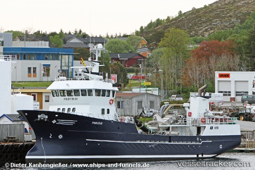
 RONJA ODE
Current Status
Where is the vessel?
RONJA ODE is currently in Near Averøy, based on AIS data received about 14h ago.
Latest AIS update:
Current position: 63.06397° N, 7.50287° E (Near Averøy)
Average speed (last 7 days): Loading…
Average speed (last 30 days): Loading…
Vessel profile: RONJA ODE is a Fish Carrier with dimensions m x m.
This page combines live AIS, route history, probable destination signals, nearby traffic, and port activity for practical vessel monitoring.
The current position of vessel RONJA ODE is 63.06397 lat / 7.50287 lng. Updated: 2026-05-22 16:41:44 UTCNearest reference points:
- Near ELNESVAGEN
- Near Kristiansund
- Near Smøla
Currently sailing under the flag of Norway ![]()
Details:
Live Vessel RONJA ODE Analytics (details, animations, etc.)
Recent AIS points (UTC):
2026-05-22 13:09:15 UTC · 63.05713, 7.51558 · SOG 0 kn · COG 218°2026-05-22 13:31:14 UTC · 63.05712, 7.51556 · SOG 0 kn · COG 218°
2026-05-22 15:43:54 UTC · 63.06395, 7.50288 · SOG 0 kn · COG 156°
2026-05-22 16:41:44 UTC · 63.06397, 7.50287 · SOG 0 kn · COG 156°