 Hanne Knutsen
Current Status
Where is the vessel?
Hanne Knutsen is currently in 18 nm W of Tune, based on AIS data received about 14h ago.
Latest AIS update:
Current position: 60.49965° N, 2.07283° E (18 nm W of Tune)
Average speed (last 7 days): Loading…
Average speed (last 30 days): Loading…
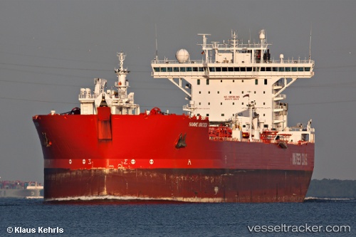
Vessel profile: Hanne Knutsen is a Fso Oil with dimensions 265m x 265m.
This page combines live AIS, route history, probable destination signals, nearby traffic, and port activity for practical vessel monitoring.
The current position of vessel Hanne Knutsen is 60.49965 lat / 2.07283 lng. Updated: 2026-05-22 11:35:35 UTCNearest reference points:
- 10 nm N of Leadon
- Near Alba Oil Field
Currently sailing under the flag of Norway ![]()
Hanne Knutsen built in 2000 year
Deadweight:
123581 tDetails:
Live Vessel Hanne Knutsen Analytics (details, animations, etc.)
Recent AIS points (UTC):
2026-05-22 08:17:29 UTC · 60.49960, 2.07235 · SOG 0 kn · COG 157°2026-05-22 09:23:30 UTC · 60.49950, 2.07191 · SOG 0 kn · COG 151°
2026-05-22 09:59:31 UTC · 60.49951, 2.07197 · SOG 0 kn · COG 152°
2026-05-22 11:35:35 UTC · 60.49965, 2.07283 · SOG 0 kn · COG 165°