 vesseltracker.com
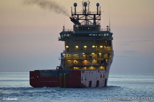
 Siddis Mariner
Current Status
Where is the vessel?
Siddis Mariner is currently in 22 nm E of Bentley FPSO, based on AIS data received about 14h ago.
Latest AIS update:
Current position: 60.05040° N, 2.39781° E (22 nm E of Bentley FPSO)
Average speed (last 7 days): Loading…
Average speed (last 30 days): Loading…
Vessel profile: Siddis Mariner is a Offshore Tug Supply Ship with dimensions 88m x 20m.
This page combines live AIS, route history, probable destination signals, nearby traffic, and port activity for practical vessel monitoring.
The current position of vessel Siddis Mariner is 60.05040 lat / 2.39781 lng. Updated: 2026-05-17 20:07:58 UTCNearest reference points:
- 10 nm N of Leadon
- Near Alba Oil Field
- Near Solund
Currently sailing under the flag of Norway ![]()
Siddis Mariner built in 2011 year
Deadweight:
4800 tDetails:
Live Vessel Siddis Mariner Analytics (details, animations, etc.)
Recent AIS points (UTC):
2026-05-17 16:13:58 UTC · 60.05076, 2.52604 · SOG 1.4 kn · COG 242°2026-05-17 18:06:19 UTC · 60.05060, 2.47526 · SOG 1 kn · COG 149°
2026-05-17 19:32:10 UTC · 60.05049, 2.41368 · SOG 1.3 kn · COG 89°
2026-05-17 20:07:58 UTC · 60.05040, 2.39781 · SOG 0.2 kn · COG 90°