 Peley
Peley
Current Status
Where is the vessel?
Peley is currently in 88 nm W of Wakkanai, based on AIS data received about 1d ago.
Latest AIS update:
Current position: 44.85706° N, 139.75703° E (88 nm W of Wakkanai)
Average speed (last 7 days): Loading…
Average speed (last 30 days): Loading…
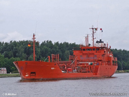
Vessel profile: Peley is a Chemical Oil Products Tanker with dimensions 14m x 81m.
This page combines live AIS, route history, probable destination signals, nearby traffic, and port activity for practical vessel monitoring.
The current position of vessel Peley is 44.85706 lat / 139.75703 lng. Updated: 2026-05-21 08:31:52 UTCNearest reference points:
- 90 nm NW of OKUSHIRI
- 40 nm NW of NEVELSK
- Near Cape Crillon
Currently sailing under the flag of Russia ![]()
Peley built in 1986 year
Deadweight:
3284 tDetails:
Live Vessel Peley Analytics (details, animations, etc.)
Recent AIS points (UTC):
2026-05-21 08:31:52 UTC · 44.85706, 139.75703 · SOG 10.8 kn · COG 214°2026-05-21 08:31:52 UTC · 44.85706, 139.75703 · SOG 10.8 kn · COG 214°
2026-05-21 08:31:52 UTC · 44.85706, 139.75703 · SOG 10.8 kn · COG 214°
2026-05-21 08:31:52 UTC · 44.85706, 139.75703 · SOG 10.8 kn · COG 214°