 K PACIFIC
Current Status
Where is the vessel?
K PACIFIC is currently in Near Taicang, based on AIS data received about 15h ago.
Latest AIS update:
Current position: 31.65184° N, 121.21152° E (Near Taicang)
Average speed (last 7 days): Loading…
Average speed (last 30 days): Loading…
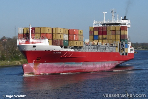
Vessel profile: K PACIFIC is a Container Ship with dimensions m x m.
This page combines live AIS, route history, probable destination signals, nearby traffic, and port activity for practical vessel monitoring.
The current position of vessel K PACIFIC is 31.65184 lat / 121.21152 lng. Updated: 2026-05-20 19:02:56 UTCNearest reference points:
- Near Taicang
- Near Jiading
- Near Chongming
Currently sailing under the flag of Antigua and Barbuda ![]()
Details:
Live Vessel K PACIFIC Analytics (details, animations, etc.)
Recent AIS points (UTC):
2026-05-20 15:50:49 UTC · 31.65183, 121.21153 · SOG 0 kn · COG 309°2026-05-20 17:05:54 UTC · 31.65190, 121.21150 · SOG 0 kn · COG 308°
2026-05-20 18:17:54 UTC · 31.65187, 121.21153 · SOG 0 kn · COG 309°
2026-05-20 19:02:56 UTC · 31.65184, 121.21152 · SOG 0 kn · COG 310°