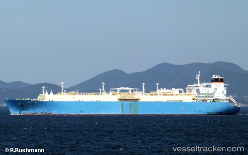
Tangguh Sago
Current StatusWhere is the vessel?
Tangguh Sago is currently in 124 nm NW of MANADO, based on AIS data received about 14h ago.
Latest AIS update:
Current position: 3.38667° N, 124.01500° E (124 nm NW of MANADO)
Average speed (last 7 days): Loading…
Average speed (last 30 days): Loading…
Vessel profile: Tangguh Sago is a Lng Tanker with dimensions 44m x 288m.
This page combines live AIS, route history, probable destination signals, nearby traffic, and port activity for practical vessel monitoring.
The current position of vessel Tangguh Sago is 3.38667 lat / 124.01500 lng. Updated: 2026-05-20 07:47:03 UTCNearest reference points:
- Near BITUNG
- 48 nm N of Melonguanne
Details:
Live Vessel Tangguh Sago Analytics (details, animations, etc.)
Recent AIS points (UTC):
2026-05-20 04:07:58 UTC · 4.24500, 124.09833 · SOG 14 kn · COG -1°2026-05-20 05:19:58 UTC · 3.94167, 124.11167 · SOG 14 kn · COG -1°
2026-05-20 07:47:03 UTC · 3.38667, 124.01500 · SOG 14 kn · COG -1°
2026-05-20 07:47:03 UTC · 3.38667, 124.01500 · SOG 14 kn · COG -1°