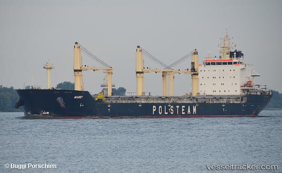
 Mamry
Mamry
Current Status
Where is the vessel?
Mamry is currently in Near DUNMORE EAST, based on AIS data received about 14h ago.
Latest AIS update:
Current position: 52.05167° N, 7.19333° W (Near DUNMORE EAST)
Average speed (last 7 days): Loading…
Average speed (last 30 days): Loading…
Vessel profile: Mamry is a Bulk Carrier with dimensions 190m x 190m.
This page combines live AIS, route history, probable destination signals, nearby traffic, and port activity for practical vessel monitoring.
The current position of vessel Mamry is 52.05167 lat / -7.19333 lng. Updated: 2026-05-23 05:35:16 UTCNearest reference points:
- Near HELVICK
- Near WEXFORD
- Near Cobn
Currently sailing under the flag of Bahamas ![]()
Mamry built in 2012 year
Deadweight:
30206 tDetails:
Live Vessel Mamry Analytics (details, animations, etc.)
Recent AIS points (UTC):
2026-05-23 01:36:50 UTC · 52.05182, -7.19379 · SOG 0 kn · COG 224°2026-05-23 03:45:54 UTC · 52.05164, -7.19347 · SOG 0.3 kn · COG 238°
2026-05-23 04:39:50 UTC · 52.05136, -7.19302 · SOG 0.4 kn · COG 248°
2026-05-23 05:35:16 UTC · 52.05167, -7.19333 · SOG 0 kn · COG -1°