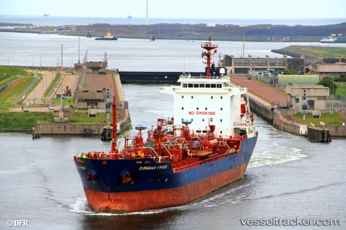
 CUMBRIAN
Current Status
Where is the vessel?
CUMBRIAN is currently in 21 nm W of Kythnos, based on AIS data received about 14h ago.
Latest AIS update:
Current position: 37.34121° N, 23.96805° E (21 nm W of Kythnos)
Average speed (last 7 days): Loading…
Average speed (last 30 days): Loading…
Vessel profile: CUMBRIAN is a Oil/Chemical Tanker with dimensions m x m.
This page combines live AIS, route history, probable destination signals, nearby traffic, and port activity for practical vessel monitoring.
The current position of vessel CUMBRIAN is 37.34121 lat / 23.96805 lng. Updated: 2026-05-18 18:22:17 UTCNearest reference points:
- Near Methana
- Near Kéa (Tzia)
- Near LAVRIO MARINA
Currently sailing under the flag of Barbados ![]()
Details:
Live Vessel CUMBRIAN Analytics (details, animations, etc.)
Recent AIS points (UTC):
2026-05-18 13:33:57 UTC · 36.48645, 23.30098 · SOG 12.1 kn · COG 29°2026-05-18 16:02:38 UTC · 36.93800, 23.61609 · SOG 12.7 kn · COG 37°
2026-05-18 16:56:17 UTC · 37.08973, 23.75300 · SOG 12.6 kn · COG 37°
2026-05-18 18:22:17 UTC · 37.34121, 23.96805 · SOG 12.4 kn · COG 34°