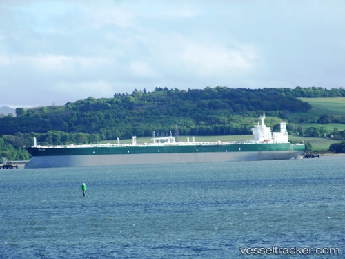
 ABIE
ABIE
Current Status
Where is the vessel?
ABIE is currently in Near SHENZHEN, based on AIS data received about 14h ago.
Latest AIS update:
Current position: 22.50274° N, 113.84464° E (Near SHENZHEN)
Average speed (last 7 days): Loading…
Average speed (last 30 days): Loading…
Vessel profile: ABIE is a Crude Oil Tanker with dimensions m x m.
This page combines live AIS, route history, probable destination signals, nearby traffic, and port activity for practical vessel monitoring.
The current position of vessel ABIE is 22.50274 lat / 113.84464 lng. Updated: 2026-05-20 04:43:31 UTCNearest reference points:
- Near SHENZHEN
- Near CHIWAN
- Near Da Chan Bay
Currently sailing under the flag of Barbados ![]()
Details:
Live Vessel ABIE Analytics (details, animations, etc.)
Recent AIS points (UTC):
2026-05-20 02:05:18 UTC · 22.50276, 113.84458 · SOG 0.1 kn · COG -1°2026-05-20 02:14:15 UTC · 22.50273, 113.84458 · SOG 0 kn · COG -1°
2026-05-20 03:40:28 UTC · 22.50019, 113.84452 · SOG 0 kn · COG 313°
2026-05-20 04:43:31 UTC · 22.50274, 113.84464 · SOG 0 kn · COG -1°