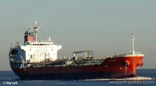
 MALED
MALED
Current Status
Where is the vessel?
MALED is currently in 38 nm W of Mathilakam, based on AIS data received about 14h ago.
Latest AIS update:
Current position: 10.20667° N, 75.52667° E (38 nm W of Mathilakam)
Average speed (last 7 days): Loading…
Average speed (last 30 days): Loading…
Vessel profile: MALED is a Oil/Chemical Tanker with dimensions m x m.
This page combines live AIS, route history, probable destination signals, nearby traffic, and port activity for practical vessel monitoring.
The current position of vessel MALED is 10.20667 lat / 75.52667 lng. Updated: 2026-05-23 07:22:46 UTCNearest reference points:
- Near Cochin
- Near Edappally
- 45 nm SW of Kalpeni Island
Currently sailing under the flag of Barbados ![]()
Details:
Live Vessel MALED Analytics (details, animations, etc.)
Recent AIS points (UTC):
2026-05-23 03:32:55 UTC · 9.88265, 75.67966 · SOG 6 kn · COG -1°2026-05-23 04:13:54 UTC · 9.95002, 75.69749 · SOG 5.9 kn · COG 12°
2026-05-23 06:04:45 UTC · 10.10833, 75.65167 · SOG 5 kn · COG -1°
2026-05-23 07:22:46 UTC · 10.20667, 75.52667 · SOG 7 kn · COG -1°