 ONTARIO VENTURE
Current Status
Where is the vessel?
ONTARIO VENTURE is currently in Near China Township, based on AIS data received about 15h ago.
Latest AIS update:
Current position: 42.73466° N, 82.48309° W (Near China Township)
Average speed (last 7 days): Loading…
Average speed (last 30 days): Loading…
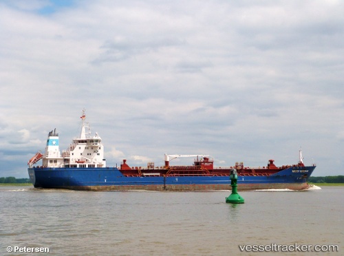
Vessel profile: ONTARIO VENTURE is a Oil/Chemical Tanker with dimensions m x m.
This page combines live AIS, route history, probable destination signals, nearby traffic, and port activity for practical vessel monitoring.
The current position of vessel ONTARIO VENTURE is 42.73466 lat / -82.48309 lng. Updated: 2026-05-19 17:48:28 UTCNearest reference points:
- Near Fort Gratiot
- Near Saint Clair Shores
- Near Walkerville
Currently sailing under the flag of Canada ![]()
Details:
Live Vessel ONTARIO VENTURE Analytics (details, animations, etc.)
Recent AIS points (UTC):
2026-05-19 13:57:26 UTC · 43.38249, -82.40648 · SOG 12 kn · COG 180°2026-05-19 16:05:07 UTC · 42.98296, -82.41937 · SOG 9 kn · COG 149°
2026-05-19 16:12:57 UTC · 42.96618, -82.41710 · SOG 7.7 kn · COG 206°
2026-05-19 17:48:28 UTC · 42.73466, -82.48309 · SOG 8.6 kn · COG 190°