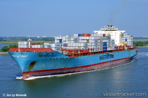
 Maersk Atlanta
Current Status
Where is the vessel?
Maersk Atlanta is currently in Near Shoreacres, based on AIS data received about 14h ago.
Latest AIS update:
Current position: 29.61333° N, 95.00667° W (Near Shoreacres)
Average speed (last 7 days): Loading…
Average speed (last 30 days): Loading…
Vessel profile: Maersk Atlanta is a Container Ship with dimensions 299m x 40m.
This page combines live AIS, route history, probable destination signals, nearby traffic, and port activity for practical vessel monitoring.
The current position of vessel Maersk Atlanta is 29.61333 lat / -95.00667 lng. Updated: 2026-05-29 12:13:27 UTCNearest reference points:
- Near Shoreacres
- Near Clear Lake Shores
- Near Morgan Point
Currently sailing under the flag of USA ![]()
Maersk Atlanta built in 2006 year
Deadweight:
84676 tDetails:
Live Vessel Maersk Atlanta Analytics (details, animations, etc.)
Recent AIS points (UTC):
2026-05-29 07:54:29 UTC · 29.61262, -95.00606 · SOG 0 kn · COG 89°2026-05-29 10:03:29 UTC · 29.61263, -95.00608 · SOG 0 kn · COG 89°
2026-05-29 10:39:31 UTC · 29.61263, -95.00607 · SOG 0 kn · COG 89°
2026-05-29 12:13:27 UTC · 29.61333, -95.00667 · SOG 0 kn · COG -1°