 BLUE STAR
Current Status
Where is the vessel?
BLUE STAR is currently in Near Abidjan, based on AIS data received about 14h ago.
Latest AIS update:
Current position: 5.26630° N, 4.04483° W (Near Abidjan)
Average speed (last 7 days): Loading…
Average speed (last 30 days): Loading…
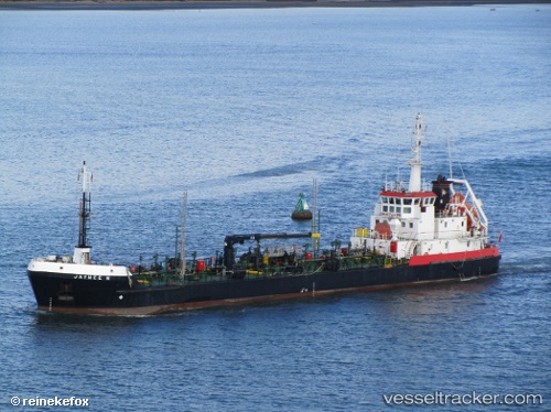
Vessel profile: BLUE STAR is a Oil Products Tanker with dimensions m x m.
This page combines live AIS, route history, probable destination signals, nearby traffic, and port activity for practical vessel monitoring.
The current position of vessel BLUE STAR is 5.26630 lat / -4.04483 lng. Updated: 2026-05-19 03:44:21 UTCNearest reference points:
- Near Vridi
- Near Abidjan
- Near Espoir
Currently sailing under the flag of Saint Kitts and Nevis ![]()
Details:
Live Vessel BLUE STAR Analytics (details, animations, etc.)
Recent AIS points (UTC):
2026-05-18 23:56:10 UTC · 5.26576, -4.04331 · SOG 0 kn · COG 326°2026-05-19 01:32:19 UTC · 5.26665, -4.04446 · SOG 0 kn · COG 157°
2026-05-19 01:32:19 UTC · 5.26665, -4.04446 · SOG 0 kn · COG 157°
2026-05-19 03:44:21 UTC · 5.26630, -4.04483 · SOG 0 kn · COG 110°