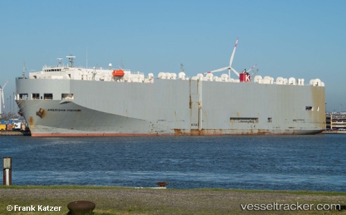
American Highway
Current StatusWhere is the vessel?
American Highway is currently in 66 nm SW of Yanbu, based on AIS data received about 14h ago.
Latest AIS update:
Current position: 23.39027° N, 37.09504° E (66 nm SW of Yanbu)
Average speed (last 7 days): Loading…
Average speed (last 30 days): Loading…
Vessel profile: American Highway is a Vehicles Carrier with dimensions 32m x 180m.
This page combines live AIS, route history, probable destination signals, nearby traffic, and port activity for practical vessel monitoring.
The current position of vessel American Highway is 23.39027 lat / 37.09504 lng. Updated: 2026-05-19 01:36:59 UTCNearest reference points:
- 74 nm SW of Yanbu
- 30 nm SW of Yanbu
- 95 nm SW of Al Muajjiz
Details:
Live Vessel American Highway Analytics (details, animations, etc.)
Recent AIS points (UTC):
2026-05-18 22:54:59 UTC · 22.75478, 37.54962 · SOG 16.9 kn · COG 329°2026-05-18 23:34:29 UTC · 22.91100, 37.44172 · SOG 16.8 kn · COG 329°
2026-05-19 01:29:29 UTC · 23.36140, 37.11752 · SOG 17.1 kn · COG 322°
2026-05-19 01:36:59 UTC · 23.39027, 37.09504 · SOG 16.9 kn · COG 325°