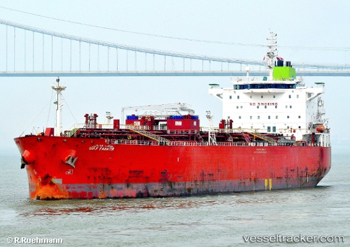
 GULF FANATIR
Current Status
Where is the vessel?
GULF FANATIR is currently in 301 nm N of Ramalde, based on AIS data received about 14h ago.
Latest AIS update:
Current position: 36.35944° S, 6.84138° W (301 nm N of Ramalde)
Average speed (last 7 days): Loading…
Average speed (last 30 days): Loading…
Vessel profile: GULF FANATIR is a Oil/Chemical Tanker with dimensions m x m.
This page combines live AIS, route history, probable destination signals, nearby traffic, and port activity for practical vessel monitoring.
The current position of vessel GULF FANATIR is -36.35944 lat / -6.84138 lng. Updated: 2026-05-22 23:46:46 UTCNearest reference points:
- Open sea, approx. 401 nm off the nearest listed port
- Open sea, approx. 403 nm off the nearest listed port
- Open sea, approx. 407 nm off the nearest listed port
Currently sailing under the flag of Panama ![]()
Details:
Live Vessel GULF FANATIR Analytics (details, animations, etc.)
Recent AIS points (UTC):
2026-05-22 20:23:30 UTC · -36.29570, -7.68062 · SOG 12.1 kn · COG 100°2026-05-22 22:12:57 UTC · -36.33212, -7.22919 · SOG 12.1 kn · COG 97°
2026-05-22 22:32:47 UTC · -36.33748, -7.14596 · SOG 12.3 kn · COG 97°
2026-05-22 23:46:46 UTC · -36.35944, -6.84138 · SOG 11.9 kn · COG 96°