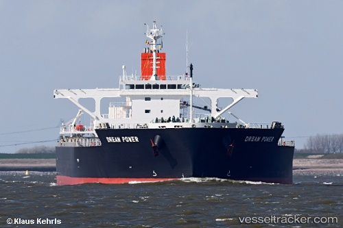
Dream Power
Current StatusWhere is the vessel?
Dream Power is currently in 29 nm SW of Abakaliki, based on AIS data received about 14h ago.
Latest AIS update:
Current position: 5.92167° N, 85.74333° E (29 nm SW of Abakaliki)
Average speed (last 7 days): Loading…
Average speed (last 30 days): Loading…
Vessel profile: Dream Power is a Bulk Carrier with dimensions 43m x 255m.
This page combines live AIS, route history, probable destination signals, nearby traffic, and port activity for practical vessel monitoring.
The current position of vessel Dream Power is 5.92167 lat / 85.74333 lng. Updated: 2026-05-23 06:35:31 UTCNearest reference points:
- 23 nm S of Abakaliki
- 46 nm SW of Abakaliki
- 127 nm W of Abakaliki
Details:
Live Vessel Dream Power Analytics (details, animations, etc.)
Recent AIS points (UTC):
2026-05-23 02:17:25 UTC · 5.92833, 86.40333 · SOG 9 kn · COG -1°2026-05-23 03:20:24 UTC · 5.92833, 86.24166 · SOG 9 kn · COG -1°
2026-05-23 04:47:24 UTC · 5.91167, 86.01667 · SOG 9 kn · COG -1°
2026-05-23 06:35:31 UTC · 5.92167, 85.74333 · SOG 9 kn · COG -1°