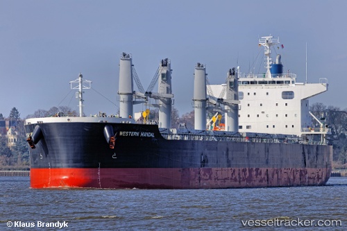
African Arrow
Current StatusWhere is the vessel?
African Arrow is currently in 57 nm NW of Okha, based on AIS data received about 14h ago.
Latest AIS update:
Current position: 22.86617° N, 68.15440° E (57 nm NW of Okha)
Average speed (last 7 days): Loading…
Average speed (last 30 days): Loading…
Vessel profile: African Arrow is a Bulk Carrier with dimensions 33m x 199m.
This page combines live AIS, route history, probable destination signals, nearby traffic, and port activity for practical vessel monitoring.
The current position of vessel African Arrow is 22.86617 lat / 68.15440 lng. Updated: 2026-05-21 14:21:55 UTCNearest reference points:
- 13 nm W of Måndvi
- Near Khambhaliya
- 49 nm S of Positra
Details:
Live Vessel African Arrow Analytics (details, animations, etc.)
Recent AIS points (UTC):
2026-05-21 10:36:16 UTC · 22.86620, 68.15452 · SOG 0.1 kn · COG 253°2026-05-21 11:56:17 UTC · 22.86590, 68.15464 · SOG 0.2 kn · COG 261°
2026-05-21 13:14:27 UTC · 22.86616, 68.15442 · SOG 0.1 kn · COG 258°
2026-05-21 14:21:55 UTC · 22.86617, 68.15440 · SOG 0.4 kn · COG 257°