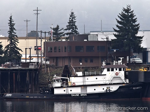
 Tecumseh
Current Status
Where is the vessel?
Tecumseh is currently in 49 nm SW of Tatoosh Island, based on AIS data received about 14h ago.
Latest AIS update:
Current position: 47.64686° N, 125.28190° W (49 nm SW of Tatoosh Island)
Average speed (last 7 days): Loading…
Average speed (last 30 days): Loading…
Vessel profile: Tecumseh is a Tug with dimensions 38m x 11m.
This page combines live AIS, route history, probable destination signals, nearby traffic, and port activity for practical vessel monitoring.
The current position of vessel Tecumseh is 47.64686 lat / -125.28190 lng. Updated: 2026-05-22 01:29:46 UTCNearest reference points:
- 21 nm NW of Tatoosh Island
- Near Clallam Bay
- Near Grays Harbor City
Currently sailing under the flag of USA ![]()
Details:
Live Vessel Tecumseh Analytics (details, animations, etc.)
Recent AIS points (UTC):
2026-05-21 20:08:49 UTC · 48.26851, -125.03787 · SOG 7.4 kn · COG 210°2026-05-21 21:45:59 UTC · 48.09266, -125.15823 · SOG 6.9 kn · COG 208°
2026-05-21 22:37:05 UTC · 47.99833, -125.21333 · SOG 7 kn · COG -1°
2026-05-22 01:29:46 UTC · 47.64686, -125.28190 · SOG 7.7 kn · COG 179°