 vesseltracker.com
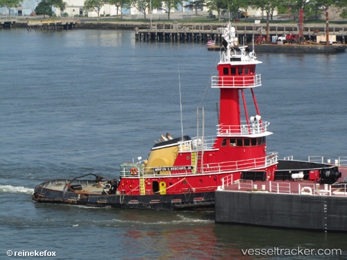
 STASINOS BOYS
Current Status
Where is the vessel?
STASINOS BOYS is currently in 16 nm S of HATTERAS, based on AIS data received about 15h ago.
Latest AIS update:
Current position: 34.94627° N, 75.60929° W (16 nm S of HATTERAS)
Average speed (last 7 days): Loading…
Average speed (last 30 days): Loading…
Vessel profile: STASINOS BOYS is a Tug with dimensions m x m.
This page combines live AIS, route history, probable destination signals, nearby traffic, and port activity for practical vessel monitoring.
The current position of vessel STASINOS BOYS is 34.94627 lat / -75.60929 lng. Updated: 2026-05-18 01:21:21 UTCNearest reference points:
- Near HATTERAS
- 18 nm NE of Rodanthe
- Near Nags Head
Currently sailing under the flag of United States ![]()
Details:
Live Vessel STASINOS BOYS Analytics (details, animations, etc.)
Recent AIS points (UTC):
2026-05-17 22:09:11 UTC · 35.11203, -75.36253 · SOG 4 kn · COG 219°2026-05-17 22:22:28 UTC · 35.10202, -75.37723 · SOG 4.4 kn · COG 232°
2026-05-17 23:34:16 UTC · 35.04866, -75.47511 · SOG 5 kn · COG 238°
2026-05-18 01:21:21 UTC · 34.94627, -75.60929 · SOG 5.2 kn · COG 227°