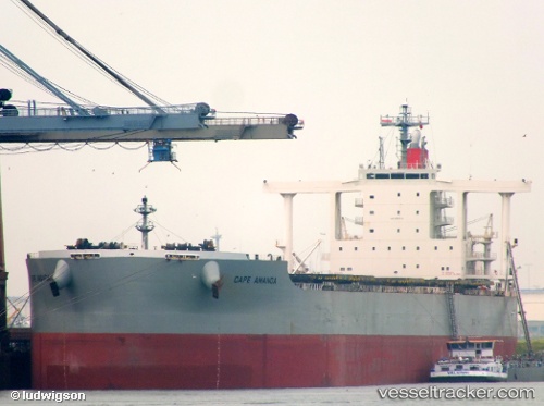
Cape Amanda
Current StatusWhere is the vessel?
Cape Amanda is currently in Near Mundra, based on AIS data received about 14h ago.
Latest AIS update:
Current position: 22.66054° N, 69.55159° E (Near Mundra)
Average speed (last 7 days): Loading…
Average speed (last 30 days): Loading…
Vessel profile: Cape Amanda is a Bulk Carrier with dimensions 45m x 292m.
This page combines live AIS, route history, probable destination signals, nearby traffic, and port activity for practical vessel monitoring.
The current position of vessel Cape Amanda is 22.66054 lat / 69.55159 lng. Updated: 2026-05-18 22:05:18 UTCNearest reference points:
- Near Mundra
- Near SIKKA
- Near Khambhaliya
Details:
Live Vessel Cape Amanda Analytics (details, animations, etc.)
Recent AIS points (UTC):
2026-05-18 19:41:15 UTC · 22.58233, 69.30381 · SOG 12 kn · COG 91°2026-05-18 20:14:06 UTC · 22.60712, 69.40411 · SOG 8.2 kn · COG 64°
2026-05-18 21:50:36 UTC · 22.66041, 69.55264 · SOG 0.2 kn · COG 37°
2026-05-18 22:05:18 UTC · 22.66054, 69.55159 · SOG 0.1 kn · COG 46°