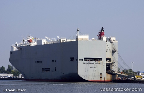
Guangzou Highway
Current StatusWhere is the vessel?
Guangzou Highway is currently in Near Sambu, based on AIS data received about 14h ago.
Latest AIS update:
Current position: 1.21619° N, 103.86924° E (Near Sambu)
Average speed (last 7 days): Loading…
Average speed (last 30 days): Loading…
Vessel profile: Guangzou Highway is a Vehicles Carrier with dimensions 40m x 180m.
This page combines live AIS, route history, probable destination signals, nearby traffic, and port activity for practical vessel monitoring.
The current position of vessel Guangzou Highway is 1.21619 lat / 103.86924 lng. Updated: 2026-05-23 05:07:41 UTCNearest reference points:
- Near Choa Chu Kang
- Near Singapore
- Near Sambu
Details:
Live Vessel Guangzou Highway Analytics (details, animations, etc.)
Recent AIS points (UTC):
2026-05-23 01:40:00 UTC · 1.29365, 104.19976 · SOG 7 kn · COG 259°2026-05-23 02:03:42 UTC · 1.28680, 104.15607 · SOG 6.9 kn · COG 266°
2026-05-23 03:33:29 UTC · 1.26086, 104.00012 · SOG 4.2 kn · COG 263°
2026-05-23 05:07:41 UTC · 1.21619, 103.86924 · SOG 11 kn · COG 250°