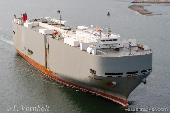
London Highway
Current StatusWhere is the vessel?
London Highway is currently in 83 nm E of Fleming, based on AIS data received about 14h ago.
Latest AIS update:
Current position: 31.03590° N, 79.45006° W (83 nm E of Fleming)
Average speed (last 7 days): Loading…
Average speed (last 30 days): Loading…
Vessel profile: London Highway is a Vehicles Carrier with dimensions 32m x 199m.
This page combines live AIS, route history, probable destination signals, nearby traffic, and port activity for practical vessel monitoring.
The current position of vessel London Highway is 31.03590 lat / -79.45006 lng. Updated: 2026-05-20 05:54:56 UTCNearest reference points:
- 33 nm S of Kiawah Island
- Near Charleston
- Near Saint Andrews
Details:
Live Vessel London Highway Analytics (details, animations, etc.)
Recent AIS points (UTC):
2026-05-20 02:20:45 UTC · 30.58069, -80.48057 · SOG 16.7 kn · COG 74°2026-05-20 03:56:21 UTC · 30.74451, -80.00091 · SOG 17.1 kn · COG 62°
2026-05-20 04:41:33 UTC · 30.85556, -79.78914 · SOG 17 kn · COG 57°
2026-05-20 05:54:56 UTC · 31.03590, -79.45006 · SOG 16.6 kn · COG 56°