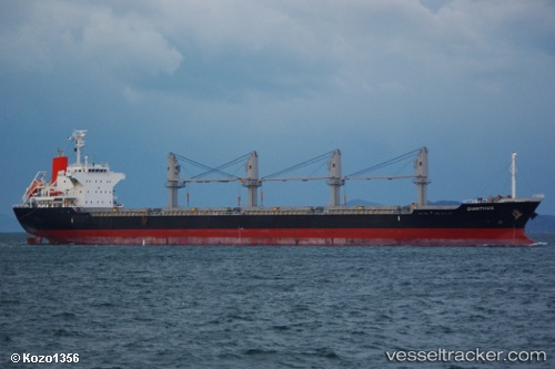
Dianthus
Current StatusWhere is the vessel?
Dianthus is currently in 41 nm S of OMAEZAKI, based on AIS data received about 14h ago.
Latest AIS update:
Current position: 33.96266° N, 138.39841° E (41 nm S of OMAEZAKI)
Average speed (last 7 days): Loading…
Average speed (last 30 days): Loading…
Vessel profile: Dianthus is a Bulk Carrier with dimensions 27m x 170m.
This page combines live AIS, route history, probable destination signals, nearby traffic, and port activity for practical vessel monitoring.
The current position of vessel Dianthus is 33.96266 lat / 138.39841 lng. Updated: 2026-05-21 13:53:04 UTCNearest reference points:
- 17 nm SW of OMAEZAKI
- Near Iruma
- Near OMAEZAKI
Details:
Live Vessel Dianthus Analytics (details, animations, etc.)
Recent AIS points (UTC):
2026-05-21 09:57:01 UTC · 33.86276, 138.22887 · SOG 2.8 kn · COG 129°2026-05-21 11:41:23 UTC · 33.91341, 138.30891 · SOG 2.9 kn · COG 114°
2026-05-21 12:19:13 UTC · 33.93017, 138.33601 · SOG 2.3 kn · COG 107°
2026-05-21 13:53:04 UTC · 33.96266, 138.39841 · SOG 2.3 kn · COG 107°