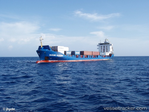
 TROPIC MARINER
Current Status
Where is the vessel?
TROPIC MARINER is currently in Near Rivera Beach, based on AIS data received about 14h ago.
Latest AIS update:
Current position: 26.76793° N, 80.05266° W (Near Rivera Beach)
Average speed (last 7 days): Loading…
Average speed (last 30 days): Loading…
Vessel profile: TROPIC MARINER is a Container Ship with dimensions m x m.
This page combines live AIS, route history, probable destination signals, nearby traffic, and port activity for practical vessel monitoring.
The current position of vessel TROPIC MARINER is 26.76793 lat / -80.05266 lng. Updated: 2026-05-20 19:10:10 UTCNearest reference points:
- Near Palm Beach
- Near Rivera Beach
- Near Lake Park
Currently sailing under the flag of Saint Vincent and the Grenadines ![]()
Details:
Live Vessel TROPIC MARINER Analytics (details, animations, etc.)
Recent AIS points (UTC):
2026-05-20 16:21:40 UTC · 26.76788, -80.05264 · SOG 0 kn · COG 93°2026-05-20 16:46:05 UTC · 26.76788, -80.05264 · SOG 0 kn · COG 93°
2026-05-20 17:52:06 UTC · 26.76787, -80.05265 · SOG 0 kn · COG 93°
2026-05-20 19:10:10 UTC · 26.76793, -80.05266 · SOG 0 kn · COG 93°