 vesseltracker.com
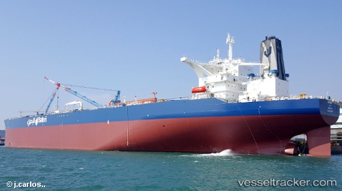
 KHURAIS
Current Status
Where is the vessel?
KHURAIS is currently in 76 nm W of Phuket International Apt, based on AIS data received about 1d ago.
Latest AIS update:
Current position: 8.30388° N, 97.05115° E (76 nm W of Phuket International Apt)
Average speed (last 7 days): Loading…
Average speed (last 30 days): Loading…
Vessel profile: KHURAIS is a Tanker with dimensions m x m.
This page combines live AIS, route history, probable destination signals, nearby traffic, and port activity for practical vessel monitoring.
The current position of vessel KHURAIS is 8.30388 lat / 97.05115 lng. Updated: 2026-05-17 03:28:56 UTCNearest reference points:
- 10 nm SW of Phuket International Apt
- Near Phuket International Apt
- Near Phuket Customs House
Currently sailing under the flag of Saudi Arabia ![]()
Details:
Live Vessel KHURAIS Analytics (details, animations, etc.)
Recent AIS points (UTC):
2026-05-17 03:28:56 UTC · 8.30388, 97.05115 · SOG 11 kn · COG 191°2026-05-17 03:28:56 UTC · 8.30388, 97.05115 · SOG 11 kn · COG 191°
2026-05-17 03:28:56 UTC · 8.30388, 97.05115 · SOG 11 kn · COG 191°
2026-05-17 03:28:56 UTC · 8.30388, 97.05115 · SOG 11 kn · COG 191°