 vesseltracker.com
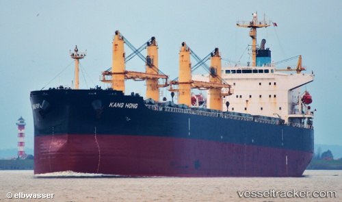
 KANG HONG
Current Status
Where is the vessel?
KANG HONG is currently in 24 nm W of Al Mukha, based on AIS data received about 15h ago.
Latest AIS update:
Current position: 13.43204° N, 42.82355° E (24 nm W of Al Mukha)
Average speed (last 7 days): Loading…
Average speed (last 30 days): Loading…
Vessel profile: KANG HONG is a Bulk Carrier with dimensions 32m x 190m.
This page combines live AIS, route history, probable destination signals, nearby traffic, and port activity for practical vessel monitoring.
The current position of vessel KANG HONG is 13.43204 lat / 42.82355 lng. Updated: 2026-05-18 08:04:14 UTCNearest reference points:
- Near Djibouti
- 81 nm NW of As Salif
Currently sailing under the flag of China Peopless Republic ![]()
KANG HONG built in 2005 year
Deadweight:
55589 tDetails:
Live Vessel KANG HONG Analytics (details, animations, etc.)
Recent AIS points (UTC):
2026-05-18 04:53:41 UTC · 12.95500, 43.19667 · SOG 10 kn · COG -1°2026-05-18 05:32:43 UTC · 13.06333, 43.15500 · SOG 10 kn · COG -1°
2026-05-18 07:08:47 UTC · 13.31167, 42.97833 · SOG 12 kn · COG -1°
2026-05-18 08:04:14 UTC · 13.43204, 42.82355 · SOG 12.4 kn · COG 308°