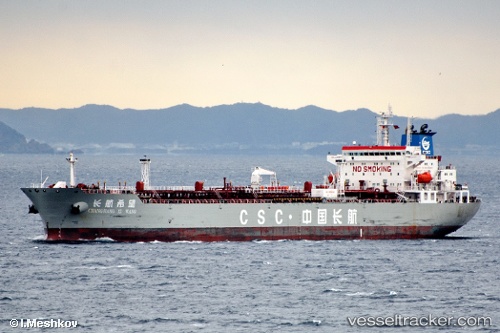
 CHANG HANG XI WANG
Current Status
Where is the vessel?
CHANG HANG XI WANG is currently in 98 nm SW of Gageohyangri, based on AIS data received about 14h ago.
Latest AIS update:
Current position: 33.38569° N, 123.29864° E (98 nm SW of Gageohyangri)
Average speed (last 7 days): Loading…
Average speed (last 30 days): Loading…
Vessel profile: CHANG HANG XI WANG is a Oil Products Tanker with dimensions m x m.
This page combines live AIS, route history, probable destination signals, nearby traffic, and port activity for practical vessel monitoring.
The current position of vessel CHANG HANG XI WANG is 33.38569 lat / 123.29864 lng. Updated: 2026-05-22 16:13:32 UTCNearest reference points:
- 99 nm NE of Yangkou Pt
- 91 nm W of Gageohyangri
- 82 nm W of Gageohyangri
Currently sailing under the flag of China ![]()
Details:
Live Vessel CHANG HANG XI WANG Analytics (details, animations, etc.)
Recent AIS points (UTC):
2026-05-22 12:01:47 UTC · 34.27733, 123.31722 · SOG 12.4 kn · COG 179°2026-05-22 13:51:20 UTC · 33.89114, 123.31806 · SOG 12.8 kn · COG -1°
2026-05-22 14:06:29 UTC · 33.83500, 123.31500 · SOG 12 kn · COG -1°
2026-05-22 16:13:32 UTC · 33.38569, 123.29864 · SOG 12.3 kn · COG -1°