 Athens Highway
Current Status
Where is the vessel?
Athens Highway is currently in Near Fort Sherman, based on AIS data received about 15h ago.
Latest AIS update:
Current position: 9.40438° N, 79.96564° W (Near Fort Sherman)
Average speed (last 7 days): Loading…
Average speed (last 30 days): Loading…
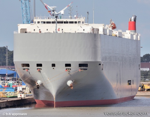
Vessel profile: Athens Highway is a Vehicles Carrier with dimensions 200m x 200m.
This page combines live AIS, route history, probable destination signals, nearby traffic, and port activity for practical vessel monitoring.
The current position of vessel Athens Highway is 9.40438 lat / -79.96564 lng. Updated: 2026-05-21 11:57:58 UTCNearest reference points:
- Near Colon
- Near Colón Free Zone
- Near COLON 2000
Currently sailing under the flag of Japan ![]()
Athens Highway built in 2008 year
Deadweight:
18809 tDetails:
Live Vessel Athens Highway Analytics (details, animations, etc.)
Recent AIS points (UTC):
2026-05-21 07:57:57 UTC · 9.40429, -79.96556 · SOG 0.2 kn · COG 4°2026-05-21 09:34:12 UTC · 9.40414, -79.96546 · SOG 0.5 kn · COG 337°
2026-05-21 10:43:08 UTC · 9.40420, -79.96558 · SOG 0.1 kn · COG 353°
2026-05-21 11:57:58 UTC · 9.40438, -79.96564 · SOG 0.1 kn · COG 10°