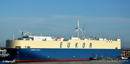
 MORNING CECILIE
Current Status
Where is the vessel?
MORNING CECILIE is currently in 297 nm E of Levelwood, based on AIS data received about 14h ago.
Latest AIS update:
Current position: 13.92177° S, 0.73645° W (297 nm E of Levelwood)
Average speed (last 7 days): Loading…
Average speed (last 30 days): Loading…
Vessel profile: MORNING CECILIE is a Vehicles Carrier with dimensions m x m.
This page combines live AIS, route history, probable destination signals, nearby traffic, and port activity for practical vessel monitoring.
The current position of vessel MORNING CECILIE is -13.92177 lat / -0.73645 lng. Updated: 2026-05-21 07:56:51 UTCNearest reference points:
- Open sea, approx. 400 nm off the nearest listed port
- Open sea, approx. 401 nm off the nearest listed port
- Open sea, approx. 402 nm off the nearest listed port
Currently sailing under the flag of South Korea ![]()
Details:
Live Vessel MORNING CECILIE Analytics (details, animations, etc.)
Recent AIS points (UTC):
2026-05-21 04:08:25 UTC · -14.79580, 0.00102 · SOG 17.6 kn · COG 321°2026-05-21 06:12:30 UTC · -14.32330, -0.40265 · SOG 17.8 kn · COG 320°
2026-05-21 06:57:31 UTC · -14.15252, -0.55013 · SOG 17.8 kn · COG 320°
2026-05-21 07:56:51 UTC · -13.92177, -0.73645 · SOG 17.5 kn · COG 322°