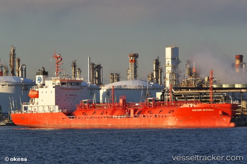
 SAEHAN MIRINAE
Current Status
Where is the vessel?
SAEHAN MIRINAE is currently in 57 nm E of Pekan, based on AIS data received about 14h ago.
Latest AIS update:
Current position: 3.40667° N, 104.36666° E (57 nm E of Pekan)
Average speed (last 7 days): Loading…
Average speed (last 30 days): Loading…
Vessel profile: SAEHAN MIRINAE is a Tanker with dimensions m x m.
This page combines live AIS, route history, probable destination signals, nearby traffic, and port activity for practical vessel monitoring.
The current position of vessel SAEHAN MIRINAE is 3.40667 lat / 104.36666 lng. Updated: 2026-05-23 08:13:26 UTCNearest reference points:
- 80 nm SW of Terempa
- 39 nm SE of Belida Terminal
- Near KEMAMAN
Currently sailing under the flag of South Korea ![]()
Details:
Live Vessel SAEHAN MIRINAE Analytics (details, animations, etc.)
Recent AIS points (UTC):
2026-05-23 05:00:06 UTC · 4.07617, 104.19372 · SOG 12.8 kn · COG -1°2026-05-23 05:59:12 UTC · 3.87282, 104.24989 · SOG 12.8 kn · COG -1°
2026-05-23 07:25:26 UTC · 3.57500, 104.32500 · SOG 12 kn · COG -1°
2026-05-23 08:13:26 UTC · 3.40667, 104.36666 · SOG 13 kn · COG -1°