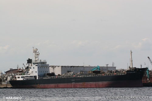
 LADY MIA
Current Status
Where is the vessel?
LADY MIA is currently in Near Poti, based on AIS data received about 14h ago.
Latest AIS update:
Current position: 42.15562° N, 41.65895° E (Near Poti)
Average speed (last 7 days): Loading…
Average speed (last 30 days): Loading…
Vessel profile: LADY MIA is a Cargo with dimensions m x m.
This page combines live AIS, route history, probable destination signals, nearby traffic, and port activity for practical vessel monitoring.
The current position of vessel LADY MIA is 42.15562 lat / 41.65895 lng. Updated: 2026-05-22 05:58:11 UTCNearest reference points:
- Near Poti
- Near KULEVI
- Near Sup'sa
Currently sailing under the flag of Palau ![]()
Details:
Live Vessel LADY MIA Analytics (details, animations, etc.)
Recent AIS points (UTC):
2026-05-22 02:25:09 UTC · 42.15563, 41.65897 · SOG 0 kn · COG 95°2026-05-22 03:37:11 UTC · 42.15559, 41.65896 · SOG 0 kn · COG 95°
2026-05-22 04:31:12 UTC · 42.15565, 41.65893 · SOG 0 kn · COG 96°
2026-05-22 05:58:11 UTC · 42.15562, 41.65895 · SOG 0.1 kn · COG 95°