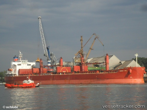
 HARVEST
Current Status
Where is the vessel?
HARVEST is currently in 14 nm W of MAILIAO, based on AIS data received about 14h ago.
Latest AIS update:
Current position: 23.69833° N, 119.92667° E (14 nm W of MAILIAO)
Average speed (last 7 days): Loading…
Average speed (last 30 days): Loading…
Vessel profile: HARVEST is a Bulk Carrier with dimensions m x m.
This page combines live AIS, route history, probable destination signals, nearby traffic, and port activity for practical vessel monitoring.
The current position of vessel HARVEST is 23.69833 lat / 119.92667 lng. Updated: 2026-05-20 16:36:04 UTCNearest reference points:
- Near MAILIAO
- Near Lung-men
- Near MAGONG
Currently sailing under the flag of Palau ![]()
Details:
Live Vessel HARVEST Analytics (details, animations, etc.)
Recent AIS points (UTC):
2026-05-20 13:08:38 UTC · 22.91047, 119.85689 · SOG 12 kn · COG 6°2026-05-20 14:30:07 UTC · 23.19017, 119.89760 · SOG 12.9 kn · COG 1°
2026-05-20 15:56:15 UTC · 23.53119, 119.91192 · SOG 15 kn · COG 3°
2026-05-20 16:36:04 UTC · 23.69833, 119.92667 · SOG 15 kn · COG -1°