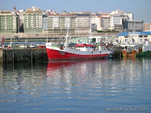
.
Vessel photo of Sir Miles (IMO 5242964) vesseltracker.com

Sir Miles

Vessel type: Fishing Vessel | IMO: 5242964 | MMSI: MMSI: 232007140
Call sign: MEIZ | Dimensions: 6 m x 32 m
Current Status

Where is the vessel?

Sir Miles is currently in Near SANTA UXIA RIBEIRA, based on AIS data received about 14h ago.

Latest AIS update:

Current position: 42.55716° N, 8.98873° W (Near SANTA UXIA RIBEIRA)

Average speed (last 7 days): Loading…

Average speed (last 30 days): Loading…

Vessel profile: Sir Miles is a Fishing Vessel with dimensions 6m x 32m.

This page combines live AIS, route history, probable destination signals, nearby traffic, and port activity for practical vessel monitoring.

The current position of vessel Sir Miles is 42.55716 lat / -8.98873 lng. Updated: 2026-05-18 01:34:06 UTC
More recent position available: 2 h 11 min ago

Shipinfo shows free vessel positions with a delay. After payment, you will be able to view the current position of this vessel for 24 hours.

We recommend registering. If you register, paid vessel access will be saved in your profile. Guest access works only through a personal link.

Nearest reference points:
  • Near Portosin
  • Near Corujo
  • Near Vigo
Details:

Live Vessel Sir Miles Analytics (details, animations, etc.)


Recent AIS points (UTC):
2026-05-17 22:20:05 UTC · 42.55716, -8.98872 · SOG 0 kn · COG 179°
2026-05-17 23:30:25 UTC · 42.55717, -8.98871 · SOG 0 kn · COG 178°
2026-05-18 01:28:55 UTC · 42.55715, -8.98871 · SOG 0 kn · COG 178°
2026-05-18 01:34:06 UTC · 42.55716, -8.98873 · SOG 0 kn · COG 179°

UTC: --
Start: -- Track timeline (UTC) End: --
Encountered: --


Link to the map:


Find another ship

Sir_Miles (232007140) last ports (portcalls and passsages)

Santa Eugenia | 2025-09-08 11:22:30
SANTA UXIA RIBEIRA | 2025-09-03 08:59:25
Santa Eugenia | 2025-09-02 14:32:28
ISLA DE AROSA | 2025-08-29 20:01:22
GROVE | 2025-08-18 07:46:20
ISLA DE AROSA | 2025-08-18 06:21:02
SANTA UXIA RIBEIRA | 2025-08-18 05:55:13
SANTA UXIA RIBEIRA | 2025-08-03 12:08:46
ISLA DE AROSA | 2025-07-30 11:33:27
PORTAVOGIE | 2025-07-26 17:50:09
ULLAPOOL | 2025-07-25 08:10:09
ULLAPOOL | 2025-07-14 09:48:55
ULLAPOOL | 2025-07-04 08:30:46
ULLAPOOL | 2025-06-14 10:10:45
ULLAPOOL | 2025-06-02 05:33:11
CORUNA | 2025-04-07 10:57:38
CORUNA | 2025-04-03 10:57:30
CORUNA | 2025-03-30 10:11:16
RATHLIN ISLAND | 2025-03-25 23:25:24
Pentland Firth | 2025-03-15 10:15:14
STROMNESS | 2025-03-15 08:31:54
Pentland Firth | 2025-02-22 05:15:59
Bishop Rock | 2025-01-31 19:23:45
CORUNA | 2025-01-29 09:58:11
CORUNA | 2025-01-25 08:59:48
CORUNA | 2025-01-21 07:47:25
CORUNA | 2025-01-17 07:33:16
RATHLIN ISLAND | 2025-01-13 19:28:52
Lerwick | 2025-01-07 10:54:09
WEST BURRAFIRTH | 2024-12-18 09:09:58
WEST BURRAFIRTH | 2024-12-04 19:41:32
Pentland Firth | 2024-11-18 03:44:27
Pentland Firth | 2024-01-28 01:37:37
Pentland Firth | 2023-12-21 17:04:41
Pentland Firth | 2023-11-16 23:13:49
La Coruna | 2023-08-08 14:08:45
La Coruna | 2023-07-17 10:28:09
La Coruna | 2023-07-08 12:26:29
La Coruna | 2023-07-04 12:09:41
La Coruna | 2023-06-30 10:35:56
La Coruna | 2023-06-26 10:30:37
La Coruna | 2023-06-22 09:45:36
Ferrol | 2023-06-22 09:16:13
Pentland Firth | 2022-10-30 11:20:36
Pentland Firth | 2022-10-10 19:35:38
Lerwick | 2022-09-30 01:24:14
La Coruna | 2022-03-20 15:00:20
Lerwick | 2022-01-04 16:15:57