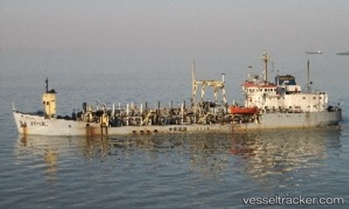
 PERINTIS 5000
Current Status
Where is the vessel?
PERINTIS 5000 is currently in 58 nm S of Labuha, Molucas, based on AIS data received about 14h ago.
Latest AIS update:
Current position: 1.57098° S, 127.38868° E (58 nm S of Labuha, Molucas)
Average speed (last 7 days): Loading…
Average speed (last 30 days): Loading…
Vessel profile: PERINTIS 5000 is a Dredging or underwater ops with dimensions m x m.
This page combines live AIS, route history, probable destination signals, nearby traffic, and port activity for practical vessel monitoring.
The current position of vessel PERINTIS 5000 is -1.57098 lat / 127.38868 lng. Updated: 2026-05-19 11:27:08 UTCNearest reference points:
- 55 nm S of Labuha, Molucas
- 69 nm NW of Wainibe
- 13 nm NE of WEDA
Currently sailing under the flag of Indonesia ![]()
Details:
Live Vessel PERINTIS 5000 Analytics (details, animations, etc.)
Recent AIS points (UTC):
2026-05-19 07:09:24 UTC · -1.57167, 127.38833 · SOG 0 kn · COG -1°2026-05-19 09:36:03 UTC · -1.57093, 127.38923 · SOG 0 kn · COG -1°
2026-05-19 11:18:06 UTC · -1.57098, 127.38884 · SOG 0 kn · COG -1°
2026-05-19 11:27:08 UTC · -1.57098, 127.38868 · SOG 0.1 kn · COG -1°