 vesseltracker.com
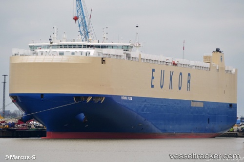
 Morning Peace
Current Status
Where is the vessel?
Morning Peace is currently in 130 nm SE of Porto Santo Island, based on AIS data received about 14h ago.
Latest AIS update:
Current position: 31.92955° N, 14.13910° W (130 nm SE of Porto Santo Island)
Average speed (last 7 days): Loading…
Average speed (last 30 days): Loading…
Vessel profile: Morning Peace is a Vehicles Carrier with dimensions 199m x 35m.
This page combines live AIS, route history, probable destination signals, nearby traffic, and port activity for practical vessel monitoring.
The current position of vessel Morning Peace is 31.92955 lat / -14.13910 lng. Updated: 2026-05-18 14:01:47 UTCNearest reference points:
- 148 nm SE of Porto Santo Island
- 109 nm E of Porto Santo Island
- 101 nm SW of Jarjis
Currently sailing under the flag of Marshall Is ![]()
Details:
Live Vessel Morning Peace Analytics (details, animations, etc.)
Recent AIS points (UTC):
2026-05-18 10:11:30 UTC · 32.97626, -13.90577 · SOG 16.6 kn · COG 190°2026-05-18 11:25:18 UTC · 32.63949, -13.99045 · SOG 16.8 kn · COG 194°
2026-05-18 13:51:18 UTC · 31.97760, -14.13155 · SOG 16.6 kn · COG 189°
2026-05-18 14:01:47 UTC · 31.92955, -14.13910 · SOG 16.6 kn · COG 189°