 GLOBE CLEOPATRA
Current Status
Where is the vessel?
GLOBE CLEOPATRA is currently in Near PUNTA DEL ESTE, based on AIS data received about 15h ago.
Latest AIS update:
Current position: 35.08101° S, 55.05174° W (Near PUNTA DEL ESTE)
Average speed (last 7 days): Loading…
Average speed (last 30 days): Loading…
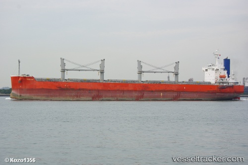
Vessel profile: GLOBE CLEOPATRA is a Bulk Carrier with dimensions 185m x 32m.
This page combines live AIS, route history, probable destination signals, nearby traffic, and port activity for practical vessel monitoring.
The current position of vessel GLOBE CLEOPATRA is -35.08101 lat / -55.05174 lng. Updated: 2026-05-22 01:50:29 UTCNearest reference points:
- 12 nm S of Piriápolis
- 21 nm E of PUNTA DEL ESTE
- 16 nm N of Cabo San Antonio
Currently sailing under the flag of Marshall Islands ![]()
GLOBE CLEOPATRA built in 2009 year
Deadweight:
58765 tDetails:
Live Vessel GLOBE CLEOPATRA Analytics (details, animations, etc.)
Recent AIS points (UTC):
2026-05-21 21:57:54 UTC · -34.97085, -54.33601 · SOG 10.2 kn · COG 242°2026-05-21 22:33:41 UTC · -35.01814, -54.44764 · SOG 10.2 kn · COG 248°
2026-05-22 01:33:00 UTC · -35.07819, -54.99672 · SOG 9.2 kn · COG 265°
2026-05-22 01:50:29 UTC · -35.08101, -55.05174 · SOG 9.1 kn · COG 265°