 ATAHUALPA
Current Status
Where is the vessel?
ATAHUALPA is currently in 118 nm N of Caleta de Sebo, based on AIS data received about 14h ago.
Latest AIS update:
Current position: 31.11380° N, 14.12970° W (118 nm N of Caleta de Sebo)
Average speed (last 7 days): Loading…
Average speed (last 30 days): Loading…
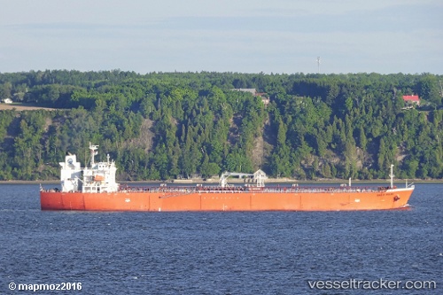
Vessel profile: ATAHUALPA is a Oil Products Tanker with dimensions 180m x 32m.
This page combines live AIS, route history, probable destination signals, nearby traffic, and port activity for practical vessel monitoring.
The current position of vessel ATAHUALPA is 31.11380 lat / -14.12970 lng. Updated: 2026-05-20 17:32:08 UTCNearest reference points:
- 148 nm SE of Porto Santo Island
- 83 nm N of Caleta de Sebo
- 58 nm N of Caleta de Sebo
Currently sailing under the flag of Marshall Islands ![]()
ATAHUALPA built in 2010 year
Deadweight:
46549 tDetails:
Live Vessel ATAHUALPA Analytics (details, animations, etc.)
Recent AIS points (UTC):
2026-05-20 13:36:39 UTC · 30.30903, -14.40100 · SOG 12.9 kn · COG 31°2026-05-20 16:02:10 UTC · 30.78255, -14.20035 · SOG 12.9 kn · COG 16°
2026-05-20 16:47:09 UTC · 30.94770, -14.15738 · SOG 13.4 kn · COG 9°
2026-05-20 17:32:08 UTC · 31.11380, -14.12970 · SOG 13.3 kn · COG 12°