 AGRI BRIGHT
Current Status
Where is the vessel?
AGRI BRIGHT is currently in 61 nm W of Port Etienne, based on AIS data received about 14h ago.
Latest AIS update:
Current position: 20.33277° N, 18.08979° W (61 nm W of Port Etienne)
Average speed (last 7 days): Loading…
Average speed (last 30 days): Loading…
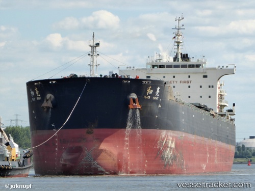
Vessel profile: AGRI BRIGHT is a Bulk Carrier with dimensions 225m x 32m.
This page combines live AIS, route history, probable destination signals, nearby traffic, and port activity for practical vessel monitoring.
The current position of vessel AGRI BRIGHT is 20.33277 lat / -18.08979 lng. Updated: 2026-05-20 05:51:36 UTCNearest reference points:
- Near Nouadhibou
- 41 nm NW of Nouadhibou
- 108 nm SW of Port Etienne
Currently sailing under the flag of Marshall Islands ![]()
AGRI BRIGHT built in 2013 year
Deadweight:
74632 tDetails:
Live Vessel AGRI BRIGHT Analytics (details, animations, etc.)
Recent AIS points (UTC):
2026-05-20 01:49:58 UTC · 19.71562, -18.08680 · SOG 8.8 kn · COG -1°2026-05-20 04:15:36 UTC · 20.08833, -18.08455 · SOG 8.8 kn · COG 0°
2026-05-20 04:29:27 UTC · 20.12295, -18.08317 · SOG 8.9 kn · COG 1°
2026-05-20 05:51:36 UTC · 20.33277, -18.08979 · SOG 9.3 kn · COG 358°