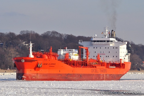
 BOW CLIPPER
Current Status
Where is the vessel?
BOW CLIPPER is currently in 49 nm NE of Port Sultan, based on AIS data received about 15h ago.
Latest AIS update:
Current position: 24.20106° N, 59.25585° E (49 nm NE of Port Sultan)
Average speed (last 7 days): Loading…
Average speed (last 30 days): Loading…
Vessel profile: BOW CLIPPER is a Chemical/Oil Products Tanker with dimensions 183m x 32m.
This page combines live AIS, route history, probable destination signals, nearby traffic, and port activity for practical vessel monitoring.
The current position of vessel BOW CLIPPER is 24.20106 lat / 59.25585 lng. Updated: 2026-05-20 01:29:50 UTCNearest reference points:
- 59 nm S of Chah Bahar
- 23 nm NE of Qalhat
- 58 nm S of JASK
Currently sailing under the flag of Marshall Islands ![]()
BOW CLIPPER built in 1995 year
Deadweight:
37221 tDetails:
Live Vessel BOW CLIPPER Analytics (details, animations, etc.)
Recent AIS points (UTC):
2026-05-19 22:49:33 UTC · 24.16500, 59.21667 · SOG 1 kn · COG -1°2026-05-19 23:07:25 UTC · 24.16833, 59.22167 · SOG 0 kn · COG -1°
2026-05-20 01:24:49 UTC · 24.19989, 59.25443 · SOG 1.3 kn · COG -1°
2026-05-20 01:29:50 UTC · 24.20106, 59.25585 · SOG 0.9 kn · COG -1°