 vesseltracker.com
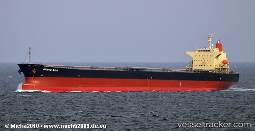
 BLUE IONIAN
Current Status
Where is the vessel?
BLUE IONIAN is currently in 227 nm NW of Bernal, based on AIS data received about 14h ago.
Latest AIS update:
Current position: 32.44740° S, 41.87022° W (227 nm NW of Bernal)
Average speed (last 7 days): Loading…
Average speed (last 30 days): Loading…
Vessel profile: BLUE IONIAN is a Bulk Carrier with dimensions 32m x 225m.
This page combines live AIS, route history, probable destination signals, nearby traffic, and port activity for practical vessel monitoring.
The current position of vessel BLUE IONIAN is -32.44740 lat / -41.87022 lng. Updated: 2026-05-18 04:54:01 UTCNearest reference points:
- 158 nm NW of Bernal
- 92 nm NW of Bernal
Currently sailing under the flag of Marshall Islands ![]()
BLUE IONIAN built in 2007 year
Deadweight:
76596 tDetails:
Live Vessel BLUE IONIAN Analytics (details, animations, etc.)
Recent AIS points (UTC):
2026-05-18 01:01:19 UTC · -32.32478, -40.89563 · SOG 13.1 kn · COG 261°2026-05-18 01:54:42 UTC · -32.35768, -41.12467 · SOG 13.3 kn · COG 260°
2026-05-18 03:37:51 UTC · -32.40837, -41.56383 · SOG 12.7 kn · COG 259°
2026-05-18 04:54:01 UTC · -32.44740, -41.87022 · SOG 12.6 kn · COG 255°