 SAFEEN AL AMAL
Current Status
Where is the vessel?
SAFEEN AL AMAL is currently in 48 nm E of Al Qusayr, based on AIS data received about 14h ago.
Latest AIS update:
Current position: 26.34310° N, 35.12435° E (48 nm E of Al Qusayr)
Average speed (last 7 days): Loading…
Average speed (last 30 days): Loading…
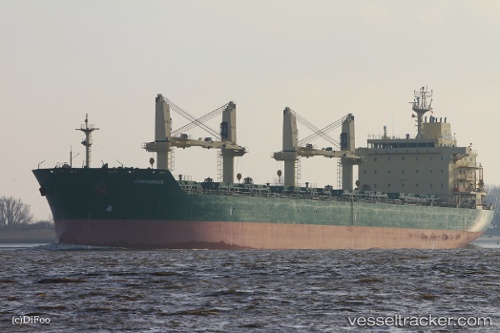
Vessel profile: SAFEEN AL AMAL is a Bulk Carrier with dimensions 180m x 30m.
This page combines live AIS, route history, probable destination signals, nearby traffic, and port activity for practical vessel monitoring.
The current position of vessel SAFEEN AL AMAL is 26.34310 lat / 35.12435 lng. Updated: 2026-05-29 12:16:24 UTCNearest reference points:
- Near Bur Safaga
- Near DUBA
- 15 nm SW of Al Khuraibah
Currently sailing under the flag of Marshall Islands ![]()
SAFEEN AL AMAL built in 2011 year
Deadweight:
34420 tDetails:
Live Vessel SAFEEN AL AMAL Analytics (details, animations, etc.)
Recent AIS points (UTC):
2026-05-29 07:39:04 UTC · 27.07824, 34.46180 · SOG 12.1 kn · COG 143°2026-05-29 09:22:23 UTC · 26.81161, 34.71051 · SOG 12.3 kn · COG 138°
2026-05-29 10:22:03 UTC · 26.65040, 34.85410 · SOG 12.3 kn · COG 135°
2026-05-29 12:16:24 UTC · 26.34310, 35.12435 · SOG 12.9 kn · COG 149°