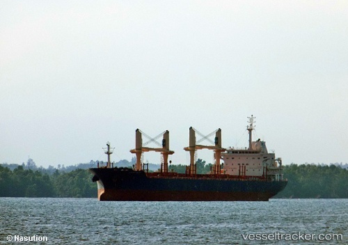
 STELIOS T
Current Status
Where is the vessel?
STELIOS T is currently in 258 nm N of Aquiraz, based on AIS data received about 15h ago.
Latest AIS update:
Current position: 0.40710° N, 28.49172° W (258 nm N of Aquiraz)
Average speed (last 7 days): Loading…
Average speed (last 30 days): Loading…
Vessel profile: STELIOS T is a Bulk Carrier with dimensions m x m.
This page combines live AIS, route history, probable destination signals, nearby traffic, and port activity for practical vessel monitoring.
The current position of vessel STELIOS T is 0.40710 lat / -28.49172 lng. Updated: 2026-05-19 13:20:01 UTCNearest reference points:
- Open sea, approx. 475 nm off the nearest listed port
- Open sea, approx. 460 nm off the nearest listed port
- Open sea, approx. 400 nm off the nearest listed port
Currently sailing under the flag of Marshall Islands ![]()
Details:
Live Vessel STELIOS T Analytics (details, animations, etc.)
Recent AIS points (UTC):
2026-05-19 10:43:25 UTC · 0.86711, -28.25894 · SOG 11.6 kn · COG 205°2026-05-19 12:11:34 UTC · 0.61050, -28.39458 · SOG 11.8 kn · COG 207°
2026-05-19 13:02:22 UTC · 0.45921, -28.46714 · SOG 11.7 kn · COG 204°
2026-05-19 13:20:01 UTC · 0.40710, -28.49172 · SOG 11.6 kn · COG 205°