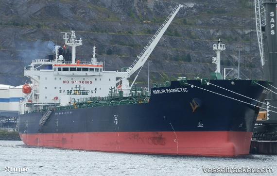
 STI MAGNETIC
Current Status
Where is the vessel?
STI MAGNETIC is currently in Near Port-Bouët, based on AIS data received about 15h ago.
Latest AIS update:
Current position: 5.23732° N, 3.95638° W (Near Port-Bouët)
Average speed (last 7 days): Loading…
Average speed (last 30 days): Loading…
Vessel profile: STI MAGNETIC is a Tanker with dimensions m x m.
This page combines live AIS, route history, probable destination signals, nearby traffic, and port activity for practical vessel monitoring.
The current position of vessel STI MAGNETIC is 5.23732 lat / -3.95638 lng. Updated: 2026-05-22 20:26:06 UTCNearest reference points:
- Near Vridi
- Near Abidjan
- Near Espoir
Currently sailing under the flag of Marshall Islands ![]()
Details:
Live Vessel STI MAGNETIC Analytics (details, animations, etc.)
Recent AIS points (UTC):
2026-05-22 16:32:02 UTC · 5.23724, -3.95639 · SOG 0.2 kn · COG 264°2026-05-22 17:50:03 UTC · 5.23729, -3.95640 · SOG 0 kn · COG 263°
2026-05-22 19:05:03 UTC · 5.23732, -3.95640 · SOG 0 kn · COG 262°
2026-05-22 20:26:06 UTC · 5.23732, -3.95638 · SOG 0 kn · COG 263°