 YANNIS PITTAS
Current Status
Where is the vessel?
YANNIS PITTAS is currently in 42 nm NW of Alozaina, based on AIS data received about 14h ago.
Latest AIS update:
Current position: 37.06385° N, 15.61111° W (42 nm NW of Alozaina)
Average speed (last 7 days): Loading…
Average speed (last 30 days): Loading…
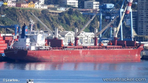
Vessel profile: YANNIS PITTAS is a Cargo with dimensions m x m.
This page combines live AIS, route history, probable destination signals, nearby traffic, and port activity for practical vessel monitoring.
The current position of vessel YANNIS PITTAS is 37.06385 lat / -15.61111 lng. Updated: 2026-05-21 06:52:20 UTCNearest reference points:
- 78 nm W of Nedroma
- 75 nm NE of Nedroma
- 74 nm E of Alozaina
Currently sailing under the flag of Marshall Islands ![]()
Details:
Live Vessel YANNIS PITTAS Analytics (details, animations, etc.)
Recent AIS points (UTC):
2026-05-21 03:58:09 UTC · 37.10885, -16.28291 · SOG 11.4 kn · COG 95°2026-05-21 05:40:28 UTC · 37.07957, -15.88398 · SOG 11 kn · COG 92°
2026-05-21 06:52:20 UTC · 37.06385, -15.61111 · SOG 11.1 kn · COG 98°
2026-05-21 06:52:20 UTC · 37.06385, -15.61111 · SOG 11.1 kn · COG 98°