 TRIDENT 9
Current Status
Where is the vessel?
TRIDENT 9 is currently in 84 nm NE of Lü-hua Shan, based on AIS data received about 14h ago.
Latest AIS update:
Current position: 31.67402° N, 123.90396° E (84 nm NE of Lü-hua Shan)
Average speed (last 7 days): Loading…
Average speed (last 30 days): Loading…
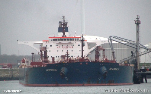
Vessel profile: TRIDENT 9 is a Crude Oil Tanker with dimensions m x m.
This page combines live AIS, route history, probable destination signals, nearby traffic, and port activity for practical vessel monitoring.
The current position of vessel TRIDENT 9 is 31.67402 lat / 123.90396 lng. Updated: 2026-05-23 04:36:47 UTCNearest reference points:
- 70 nm NE of Jingjiang
- 117 nm NE of Jingjiang
- 97 nm E of Lü-hua Shan
Currently sailing under the flag of Marshall Islands ![]()
Details:
Live Vessel TRIDENT 9 Analytics (details, animations, etc.)
Recent AIS points (UTC):
2026-05-23 01:18:43 UTC · 31.04016, 123.90230 · SOG 11.7 kn · COG 5°2026-05-23 01:49:41 UTC · 31.14148, 123.90615 · SOG 11.8 kn · COG 357°
2026-05-23 04:21:45 UTC · 31.62612, 123.90154 · SOG 11.3 kn · COG -1°
2026-05-23 04:36:47 UTC · 31.67402, 123.90396 · SOG 11.3 kn · COG -1°