 PENELOPE OLDENDORFF
Current Status
Where is the vessel?
PENELOPE OLDENDORFF is currently in 80 nm SE of Coruripe, based on AIS data received about 14h ago.
Latest AIS update:
Current position: 10.96500° S, 35.11833° W (80 nm SE of Coruripe)
Average speed (last 7 days): Loading…
Average speed (last 30 days): Loading…
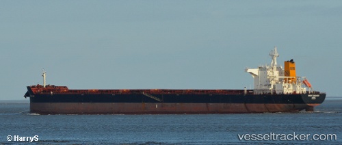
Vessel profile: PENELOPE OLDENDORFF is a Bulk Carrier with dimensions m x m.
This page combines live AIS, route history, probable destination signals, nearby traffic, and port activity for practical vessel monitoring.
The current position of vessel PENELOPE OLDENDORFF is -10.96500 lat / -35.11833 lng. Updated: 2026-05-21 13:53:32 UTCNearest reference points:
- 157 nm SE of Maceio
- Near Barra dos Coqueiros
- Near Aracaju
Currently sailing under the flag of Marshall Islands ![]()
Details:
Live Vessel PENELOPE OLDENDORFF Analytics (details, animations, etc.)
Recent AIS points (UTC):
2026-05-21 10:32:54 UTC · -11.52756, -35.36295 · SOG 10.8 kn · COG 24°2026-05-21 11:35:35 UTC · -11.35333, -35.28333 · SOG 10 kn · COG -1°
2026-05-21 13:20:35 UTC · -11.05833, -35.15833 · SOG 10 kn · COG -1°
2026-05-21 13:53:32 UTC · -10.96500, -35.11833 · SOG 10 kn · COG -1°