 LIMBO
LIMBO
Current Status
Where is the vessel?
LIMBO is currently in 253 nm SE of Mogadishu, based on AIS data received about 14h ago.
Latest AIS update:
Current position: 1.86711° S, 46.97288° E (253 nm SE of Mogadishu)
Average speed (last 7 days): Loading…
Average speed (last 30 days): Loading…
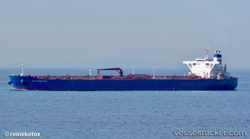
Vessel profile: LIMBO is a Tanker with dimensions m x m.
This page combines live AIS, route history, probable destination signals, nearby traffic, and port activity for practical vessel monitoring.
The current position of vessel LIMBO is -1.86711 lat / 46.97288 lng. Updated: 2026-05-21 00:22:42 UTCCurrently sailing under the flag of Marshall Islands ![]()
Details:
Live Vessel LIMBO Analytics (details, animations, etc.)
Recent AIS points (UTC):
2026-05-20 19:20:18 UTC · -1.37044, 47.82070 · SOG 11.6 kn · COG 241°2026-05-20 21:35:37 UTC · -1.58896, 47.43857 · SOG 11.5 kn · COG 237°
2026-05-20 22:44:45 UTC · -1.70667, 47.24667 · SOG 11 kn · COG -1°
2026-05-21 00:22:42 UTC · -1.86711, 46.97288 · SOG 11.8 kn · COG 240°