 vesseltracker.com
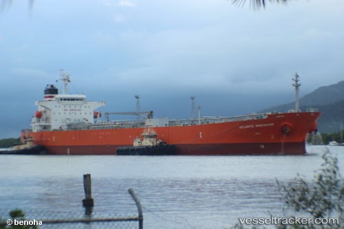
 HANSA SEALEADER
Current Status
Where is the vessel?
HANSA SEALEADER is currently in 34 nm SE of Southwest Rocks, based on AIS data received about 15h ago.
Latest AIS update:
Current position: 31.23233° S, 153.54958° E (34 nm SE of Southwest Rocks)
Average speed (last 7 days): Loading…
Average speed (last 30 days): Loading…
Vessel profile: HANSA SEALEADER is a Oil Products Tanker with dimensions m x m.
This page combines live AIS, route history, probable destination signals, nearby traffic, and port activity for practical vessel monitoring.
The current position of vessel HANSA SEALEADER is -31.23233 lat / 153.54958 lng. Updated: 2026-05-18 11:38:47 UTCNearest reference points:
- Near Warners Bay
- Near Caves Beach
- Near BILGOLA PLATEAU
Currently sailing under the flag of Marshall Islands ![]()
Details:
Live Vessel HANSA SEALEADER Analytics (details, animations, etc.)
Recent AIS points (UTC):
2026-05-18 07:42:09 UTC · -31.84192, 153.28693 · SOG 9.7 kn · COG 20°2026-05-18 10:05:35 UTC · -31.46685, 153.44550 · SOG 9.6 kn · COG 22°
2026-05-18 11:05:57 UTC · -31.32023, 153.52420 · SOG 9.8 kn · COG 16°
2026-05-18 11:38:47 UTC · -31.23233, 153.54958 · SOG 10.1 kn · COG 18°